
 A scene along the shore of Kentucky Lake and the All-Sail marina in Grand Rivers, KY
We are currently taking it easy on Kentucky Lake anchoring out as much as we can. The area has a lot of bays and coves. I assume they were named for the families that owned the land before the dams were built to create Kentucky and Barkley Lakes. It's interesting to note that the charts identify the locations of family cemeteries but not landmarks visible from the water such as smokestacks and water towers. Maybe it was a political thing.
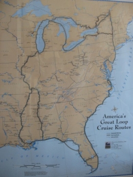
We're currently at Paris Landing Marina just inside the Tennessee border. We spent two nights at anchor at Ken Lake State Park in a creek that looks more like a lake. Lots of circa 20ft fishing boats with huge outboards (200 - 250 hp). We plan to slow down for about a week after the rather hectic river traffic. We need to wait for the end of hurricane season before we get too far south.
Some statistics: Since leaving Green Bay on 9/12/07, we have travelled 907 statute miles (s.m.) River miles are calculated in s.m. not nautical miles. We've burned 136 gal. of diesel, not bad compared to what some of the trawlers on this trip are burning. We probably burn .75 to .9 gallons per hour.
Going down the Miss. River was a bit nerve racking with the debris and current (about 4 mph) but we could make really good time. We went about 10 mph at 2000 RPM, sometimes as high as 12 mph. I did 90% of the piloting, better for my nerves plus I found it enjoyable and challenging. Had to constantly be aware of where we were in the river since the channel would tend to go from one side of the river to the other. The average depth of the channel was about 15 ft. and 9 ft. along the edges. Using the combination of paper and electronic charts made navigation fairly easy. I used the auto pilot to steer, but learned quickly not to cut too close to buoys in bends in the river because it can get shallow quickly. We saw several whirlpools in the Miss. River, but they didn't affect us; I think our keel helped us.
So far we have gone through 13 locks: 10 down and 3 up. The last was 57 ft up at Barkley Lake. The worse were the two up on the Ohio River. We were told to float rather than tie off. They are old locks and had a lot of turbulence. It's difficult to control a sailboat with the mast sticking out on each end.
To date we have anchored out 10 nights, stayed at free town docks 6 nights and been at paying marinas 20 nights. The transient rates are generally $1 per foot or less. Two places have charged us as a 47 ft boat instead of a 40 ft due to the overhang of the mast.
We were really surprised at the number of sailboats on Kentucky Lake. Em may have mentioned a marina at Grand Rivers, KY that was 100% sailboats. There were about 200 boats, many 40 ft or more. We have some bridges to the south with a clearance of 52 ft.; we need 54 to 55 ft. so we won't raise the mast until we get to Mobile.
More later - pls

No comments:
Post a Comment