Thursday, September 3, 2009

Home Again!

We left Menominee about 11 AM 8/25 after having some minor repairs done to our canvas. We were advised to have the dodger, bimini and all our canvas washed and waterproofed again as it took quite a beating being in the water year-round. We think the intense Florida sun was probably the hardest on it.

It wasn’t as brisk of a sail as the past two days but we were able to sail most of the day, just not very fast. About 4PM I was getting excited to be nearing home. I occupied myself by packing up whatever I could. Ginger wanted to see what was going on in the galley.


As you can see Ginger hung in there for the duration. We comment on that because she’s so darned old! We adopted her from the shelter 14 years ago (for Alison), her age was estimated at that time as 5 to 7 years old so who knows. I just know that she got lots of attention on this trip from people we encountered – especially little kids and elderly women. The usual questions are: “how old is your puppy?” and “what kind of dog is that?” She sure brought a lot of smiles to a lot of faces.

This is one of the channel markers for the big ships that come into Green Bay. The cormorant population is doing very well here.


This isn’t as scenic as most of the places we’ve been on the trip but the Tower Drive Bridge (or the newer name Leo Frigo Bridge) over the Fox River in Green Bay was a pretty exciting sight to us.


This is The Boat Yard near downtown Green Bay where we store for the winter and Alison waiving to us from the dock.


Here's the happy (and relieved) crew.

Just a few final statistics:
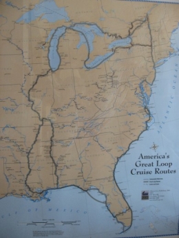
Our trip in statute (land) miles came to 6,586 miles. We went through 70 locks. The number of nights we (or just the boat) stayed in marinas was 216; nights spent at anchor was 129; nights at free docks was 57, and nights on a mooring ball was 40. Grand total: 442 nights

We’re grateful to the Good Lord for keeping us in His loving care and to family and friends for your support, prayers, blog comments, phone calls and emails along the way. Also to those who took us in: Patti and Steve in Peoria, IL, Jim and Lou in FL (several times!) and Chuck and Linda in MD for letting us use their dock on the Chesapeake. Thank you to Paul's Cousin Sandy for printing our boat cards, hooking us up with your friends in AL, the phone calls and all the special treats you sent. Thanks to my Cousin Audray for taking such good care of us in Ohio. It was great to see family along the way and to meet so many kind and helpful people all throughout the trip. We both think the Kentucky Lakes area was our favorite overall place, the Hudson River Valley in NY the most scenic, and sailing past the Statue of Liberty and going under the Brooklyn Bridge in our own boat was the most memorable experience. The members of the yacht club in Dunkirk, NY on Lake Erie are without a doubt the most friendly and hospitable group of folks we encountered.

Something happened since we’ve been back that makes us especially glad we did this trip when we did. We attended the funeral of a fellow sailor, age 69, who died from a sudden illness. He lived life to the full and took many wonderful trips with family and friends, often chartering in the Caribbean during the winter months. I know those will be precious memories for his loved ones.

We are now "graduate loopers" and can fly the gold burgee to prove it. It replaces the white one we flew during the trip. The letters AGLCA stand for "America's Great Loop Cruising Association". They have a terrific website and newsletter for members to share information about doing the trip.

The mast was taken off the boat yesterday and as of today, Restless Wind is now out of the water for the season. I think she deserves a break.  Look Ma - no barnacles!

We had a big surprise today when we came back from pulling the boat. Kyle's car was in the driveway (the son in Brooklyn, NY). Our three "kids" planned to meet us on the dock when we came back over Labor Day weekend but we spoiled the plan by coming back early. No matter - it'll be fun to have the whole family here for the weekend and we really were surprised!

Thanks for sharing our once in a lifetime adventure.

Wednesday, August 26, 2009

A Great Crossing and Loop Closing

When the weather finally cleared on Sunday, there was a mass exodus of boats from Leland and we were one of them. There was still a lot of wave action but, now, not a lot of wind so it was a little rough. Here’s a view of the sand dunes on Michigan’s beautiful coastline along the way.

We arrived after about 6 hours on the water. This is the Frankfort Light at the mouth of the Betsie River.

We tried to stay out of the way of the numerous fishermen here and anchored out with a few other boats off the Municipal Marina in Lake Betsie. We had a peaceful night and at 8AM were ready to head across the Lake. The first hour or so was motor-sailing; the seas were rather rough but not that much wind. Poor Ginger even got a little seasick. Then the wind picked up and we remembered why we got into sailing in the first place!

We were headed W/NW and the wind was W/SW so it was a close reach which changed to more of a beam reach. It was sunny all day but cool, high 60s. It was just a really enjoyable sail, averaging 6+ knots. We were out of sight of land for about 2 ½ hours. It’s understandable that the early sailors thought the earth was flat – it certainly does appear that way when you can’t see anything but water!

After about 8 hours, we saw this familiar sight - the entrance to the Sturgeon Bay Ship Canal. The white buildings are the Coast Guard Station. At 3:42 CDT we officially completed America's Great Loop as this is where we began our trip. We both were feeling a sense of relief to know we accomplished our goal. Maybe we’ll have a sense of let-down later but not today.


We called to open the Bay View Bridge but had to wait for the 5pm opening of the new Ogden St. Bridge. Just as we were going through there was some excitement. A distress call came on the radio – a woman on a sailboat asking anyone in the area to come to their aid. They had lost power and were drifting into one of the large ore boats in the harbor. Someone nearby did get there in time and here’s the Good Samaritan towing the Jacinda Rose to the same wall we were having trouble tying to (the wind was pushing us away from the wall). We finally got tied up and were able to help Jacinda Rose dock along with a few others – no easy feat. She weighs 44,000 lbs. and with the gusty wind and no power – yikes. But no damage to either boat thank goodness.  Here’s the rescuer and rescuee:

Here are the freighters the sailboat was about to drift into:

After the thousands of miles we traveled on this trip, it’s amazing to realize that we’ve never had anything really traumatic happen. Although running aground and being pulled toward that long tow off Moorehead City, SC seemed pretty scary at the time!

We planned to head to Green Bay the next day; however, since the wind was west/southwest, we would have had to motor the whole way. We decided to sail to Menominee, our home marina, instead. And we had a brisk 2 ½ hour sail from Door County across Green Bay to Menominee, MI. Wow, two consecutive days of no motoring! It was rather odd to ask for a transient slip on the radio. They put us on our old dock, just farther out, in B-29 instead of B-20. Here’s B Dock looking toward shore.

This marina has great facilities. A very comfortable boaters’ lounge, wonderful separate showers, wifi, a computer for boaters to use – so many things we took for granted before we stayed at some really sub-par marinas. We even got a free bag of ice and restaurant coupons as visitors. We sort of feel as if we’re “home” already but one more little trip to go. We’re off to Green Bay later this morning where daughter Alison will pick us up. Check back one more time for the final wrap-up.

Friday, August 21, 2009

Waiting to Cross Lake Michigan

Besides the m/v Knot Home being in Charlevoix, there were about 8 other Looper couples there. Two separate Happy Hours combined into one so everyone got acquainted. There were boaters from Florida, Florida Keys, Virginia, Ontario, Alabama, and Michigan. Also a friend of ours from Green Bay, Dan, was here on vacation on his m/v Margaretaville, so it was a fun two days in Charlevoix – even got to hear a community band concert from the boat. They had cable TV at the docks, rather a novelty since we hadn’t seen that in months.

It’s very handy being docked next to Larry “The Ice Man”. He kept us supplied with the surplus from their icemaker. This is Restless Wind and Knot Home at the new docks and Dorothy and Ginger on their boat.


Instead of anchoring out in Lake Charlevoix as planned, on Wednesday we headed out on the big water. High winds were forecast for the next day and we didn’t want to be stranded. After 5 ½ hours of mostly motoring, we came into Leland for fuel and decided to stay. They’re undergoing a renovation and expansion also. Since the showers and some other amenities won’t be finished this season, they’re offering a half price rate for dockage. This is their new unfinished facility – it’s going to be a great place to stop next summer.

Leland is a little village on the Leelanau Peninsula with neat little shops, galleries and eateries. The historical district, known as Fishtown, has the rustic shanties and docks reminiscent of a commercial fishing village over 100 years ago. It has charter fishing available and the only public ferry to the Manitou Islands, also a really nice sandy beach near the marina. This is what Lake Michigan looked like on Wednesday night from the beach – so peaceful. It hasn't looked anything like that the past two days. The howling winds make it a pretty angry looking lake.


As of this writing, we’re spending our third night in Leland. The weather predictions were correct and we’ve had two days of rain showers and very high winds. The boat is actually rocking around quite a bit in the slip! The small red flag under the US flag on this mast indicates a small craft warning is in effect. Waves occasionally spill over the rocks which is neat to see but I'm glad we're on this side of the breakwater.

The winds had been from the west but are now out of the north indicating the front is moving through. The current plan is to sail to Frankfort Saturday and cross Lake Michigan from there to Sturgeon Bay (Lord willing and the creek don’t rise). The finish line is in sight!

Thursday, August 20, 2009

Little Traverse Bay and Charlevoix

We left Mackinaw City on Saturday morning. It’s kind of a thrill passing under the huge Mackinac Bridge. It’s a real engineering marvel with a total length of 5 miles, the third longest suspension bridge in the world. It contains 42,000 miles of steel cable; five workers’ lives were lost during construction. I remember coming up here on a family car trip as a young girl when the bridge was brand new and it was a BIG deal – still is!


We’re now on the waters of Lake Michigan but it wasn’t a good sailing day. There was plenty of wind but it was right on our nose so we motor-sailed to Harbor Springs on Little Traverse Bay. This is the first time a marina has been full on this leg of the trip and there are more big yachts here than anywhere we’d been. We anchored in the harbor – deeper than we’d like at 32.5 feet but we held fine and had a peaceful night.

The next day was just a short 3-mile ride across the Bay to Petoskey. We got a slip right next to Looper friends Larry and Dorothy on m/v Knot Home. They live in Florida and are doing the Loop over 3 years; they’ll winter their boat in Michigan and continue next summer. We first met them in Charleston, SC and again on the Erie Canal last summer. It was fun to see them again and share Looper stories and dinner (Dorothy cooked dinner and we ate on our boat – such a deal!)

There was a really unusual sunset in Petoskey. This picture doesn’t do it justice but you can get the idea.

We changed our plan to stay in Petoskey another night due to weather forecasts so it was off to Charlevoix Monday AM. In about 3 hours we were in Charlevoix and just made it through the 1PM bridge opening. This will be a familiar sight to boaters in northeast Wisconsin who have cruised to Charlevoix.


I got this aerial view from a photo in the boater’s lounge. At the bottom is Lake Michigan, then the channel coming into Round Lake and Charlevoix. Lake Charlevoix is at the top of the photo. The water is a gorgeous color here and the weather actually felt summer-like for a change!

The marina here has undergone a major renovation and expansion. It now has 70 slips, beautiful landscaping and great facilities with free cable TV. (I almost forgot such a thing existed!) Marina staff will drop you off in their GEM (Global Electronic Motorcar). I'd never been in one - kind of fun to tool around town at 25mph. We also got our bikes out for a ride. There is an interactive fountain for the kids – this is looking out from the upper deck of the office and boater’s lounge. What a great marina!

Friday, August 14, 2009

Farewell Canada, Hello Michigan

Tuesday, August 11th felt like a milestone. We were able to sail most of the way to Drummond Island, MICHIGAN – back in the good old United States of America!

The U.S. Customs Agents come right to your boat to check you back into the country. We didn’t need to show our passports but many of the same questions were asked plus “did we have any citrus fruit on board?” Since we had the completed I-68 forms with us, we could have checked in by phone but we needed fuel anyway and this way seemed more official!

We anchored that night off Harbor Island, only about a mile from Drummond. We had a great 33 days in Ontario but it felt good to be back in the U.S. Paul decided he wouldn’t miss charts showing meters, fathoms and sometimes feet and the Canadian weather forecasts on the marine radio (no detailed information and the French portion seemed to be on whenever we tuned in). I will miss asking if I could have “two loonies for a twonie” for the washers!

The next day we passed the DeTour Reef Light and we were officially back into Lake Huron from the North Channel. The light marks the DeTour Passage where ships heading up the St. Mary's River would travel heading to and from Lake Superior. It looked very stately and the American flag flying proudly was a nice touch.
We anchored in the Le Cheneaux Islands, also known as “the channels” or “the snows”. Most of the islands are privately owned but Government Island is public land and has a great anchorage. We spent one night there and I can tell you the water is just as chilly here as it was in Canada – brrr! As of today we are once again able to use our cell phones. I think I’ll like not feeling so out of touch.

On Thursday we crossed the Straits of Mackinac, which has been a crossroads of the Great Lakes since 1670. It's located at the meeting of Lake Huron and Lake Michigan. We sailed around the north shore of Mackinac Island instead of the busy south side. We didn’t plan to visit the Island as we’d been there twice previously when our kids were on band trips. We got a glimpse of the Grand Hotel passing by but were able to avoid all the ferry traffic such as you see below.


We had planned to dock in St. Ignace since we hadn’t been there before but we found out through a few phone calls that in Mackinaw City, we’d have access to a diesel service facility. We were able to have someone look at the engine the next morning. Nothing major, we just needed to have the driveshaft re-aligned. We were having a lot of vibration at higher RPMs and hopefully this will take care of it.

It was fun knocking around Mackinaw City, lots of shops, lots of chances to buy FUDGE, which we did. We took a long walk up to the restored Old Mackinac Point Lighthouse. Here's part of the lighthouse with the Mackinac Bridge in the distance.

There’s a free museum telling about the building of the Mackinac Bridge, completed on November 1, 1957. Before the bridge, vehicles would take ferries from one peninsula of Michigan to the other. Now over four million vehicles cross the Bridge every year. Here’s “MIGHTY MAC” from a park on shore.


It’s really a majestic-looking sight and we’ll get an even better view tomorrow sailing under it. We feel we’re in familiar waters now since we’ve been here before. Ever Onward!!

Monday, August 10, 2009

Little Current to Thessalon

We came into Little Current Thursday, Aug. 6th. In the native tongue it’s Baiwejewung, “where the waters begin to flow”. The waters of the North Channel are funneled into a passage only 100 yards wide, creating stiff currents as they empty into Georgian Bay. The only spot we really noticed the current was going under the swing bridge. The bridge only opens on the hour so there’s quite a line-up waiting on either side of the bridge.

This is the largest town on Manitoulin Island (Spirit Island in the Ojibwe tongue) and many boaters provision here before heading out to anchorages. Manitoulin is a very large and unusual shaped island. It forms almost the entire southern shore of the North Channel. We walked up the hill for a few groceries. Here’s the view  on our walk back down to the dock.


We were on the town dock directly in front of the federal building which houses the “Bureau de Poste” (post office) and the Customs Dept. So it’s very easy for the agents to spot the boats with the American flags and pay them a visit. They mainly wanted our Canadian Customs report number, to see our passports and answers to a few questions: what did we declare to Customs when we entered Canada, how long did we plan to be in the country, etc. They filled out a form for us to display along with our customs report number.

We only enjoyed civilization for one night and were off to anchor in Clapperton Harbor. We headed that way to be closer to our destination of Kagawong, in Mudge Bay, also on Manitoulin Island. There were two items of interest that took us on this little side trip. Here’s the first, St. John Anglican Church, also known as “The Sailors’ Church”, dedicated in 1938.

Here’s the interior. The pulpit is actually part of the bow of a cruiser that was wrecked in a storm in 1965. Many other nautical touches were donated by members of Kagawong.


The other point of interest is Bridal Veil Falls, from which Kagawong actually got it’s name. It’s Ojibwe for “where the mists rise from falling waters”. We were told the water volume is down right now, at times you can walk behind the falls and even swim here. It was still neat to see as was the half-mile hike through the woods to get there.

We anchored that night in the South Benjamin Islands, a really well-known anchorage with interesting rock formations. You can go ashore here, unfortunately it was rainy when we got here and when we left in the morning.

We did a security call on the radio while traveling on Sunday. This narrow passage is the Little Detroit Strait and it’s best to let other boats know you’re coming through so there isn’t a problem.

We anchored that night off John Island, this is about 2/3 of the way across the North Channel. We decided since the weather wasn’t exactly cooperating and we would probably be back this way again sometime, we’d make a little more progress and head for Thessalon. This will be our last stop in Canada. It’s a pretty quiet little town but the marina is very nice and has bikes for boaters to use. We actually talked to three other boaters here who are either doing the Loop or planning to. It’s always fun to exchange information and experiences. So that’s all from the public library in Thessalon, Ontario.

Entering the North Channel

Killarney lies on the north shore of Georgian Bay and was once a busy commercial fishing village. It wasn’t until 1962 that it was accessible to vehicles. It now relies mostly on tourism and is known as the eastern gateway to the North Channel. This is the view leaving Killarney; the S. La Cloche Range is in the distance.

I thought this picture was noteworthy because the sun came out late morning, the first time we’d seen it in awhile.

The North Channel Waterway stretches some 160 nautical miles from Sault Ste. Marie, MI to Killarney and is known as one of the world’s finest cruising grounds. We had some pretty stiff winds but were able to sail a lot of the way to Baie Fine (pronounced Bay Finn), the only fjord in North America. We were able to sail most of the ten miles to our anchorage with the genoa only and the wind at our stern – so peaceful.

We went the 10 miles to the end of the Bay and anchored in The Pool. There were about 11 boats there for the night and only 3 were power boats. Here’s a view of part of the shoreline from our dinghy.

We dinghied to shore and hiked up the marked trail to Topaz Lake. A lot of the trail followed a dry creek bed.
We didn’t find any blueberries as we'd hoped but there is a gorgeous view of the lake. A few boaters who came up after us took a swim but we weren’t moved to do that.

When we pulled up anchor to leave the Pool, we also pulled up the biggest clump of grass we’d ever encountered. Here's Paul working on untangling the chain and anchor. It took awhile!

We anchored that night in another scenic spot off Heywood Island with a few other boats. Next stop Little Current.