
We were going against a current of approximately 3 mph so our knot meter speed and SOG (speed over ground) on the GPS were showing quite a disparity. Since it was Sunday on a holiday weekend, there were lots of power boats overtaking us. The wakes they caused added to the chop we were already feeling – rather a rough ride. Here they come!

We passed an area of McMansions along the shoreline then an industrial area, US Steel and Great Lakes Works were a couple of the larger ones. Here’s a view of the Ambassador Bridge and the skyline of Detroit. Windsor, Ontario is directly across from Detroit. Caesar’s seemed to have the most prominent buildings on the Windsor side.

Here’s the Detroit Princess Paddlewheel and the corporate offices of General Motors, which has been in the news quite often lately with all of their financial woes.

We called ahead to Kean’s Marine in Detroit for a slip for the night. I found out they don’t use the word “slip” in these parts, it’s called a WELL. We got to Well #120 about 6:15, after ten hours on the water. We were too late to get a key for the gate as the office closed at 5pm but we hadn’t planned to leave the marina anyway. You would have to get a car service to go anywhere, nothing is within walking distance and that’s not advised.
As we left Kean’s on Monday, we saw groups of junior sailors out for sailing class but were surprised as it was really windy. We saw one boat capsize but there were plenty of monitors keeping an eye on things.
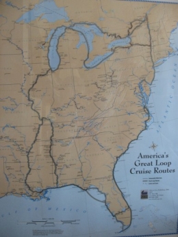
We were able to sail on a beam reach heading northeast on Lake Saint Clair, winds were from the northwest. It’s a very shallow lake, about 14 feet outside the shipping channel. We stayed in the channel as it’s the most direct route to the St. Clair River and is dredged to about 33 feet. We hit 9 knots a few times – what a treat to have the wind in our favor for a change. Here’s me taking a brief turn, it’s usually Cap’n Paul at the wheel but I’d much rather have the helm when we’re not motoring.

It seems as though as soon as we went from Ohio to Michigan, the water turned this pretty blue-green color, we think it’s the sandy bottom that causes it. It reminds me of the Florida Keys. Sometimes I find myself looking for dolphins and wondering where all the pelicans are!

After sailing ALL the way across Lake Saint Clair, we were on the St. Clair River (Saint is only abbreviated for the river for some reason). It was a rather odd feeling going down the center of the river with Michigan on our left and Ontario, Canada on our right. We got a WELL at the Harbor Club in Algonac, MI which was on a channel about a mile off the river. We spied a KFC sign within walking distance and decided to be bad to our arteries and got a carry-out. I don’t think we’d been there in years. There was no wifi or TV reception in Algonac but the showers were pretty nice.
When we left Algonac Tuesday morning, it was in the 50s and the Canadian man in the boat next to us was shirtless! I couldn’t decide if he was just very warm-blooded, showing off his tan or crazy!
We fought the current again all the way up the St. Clair River. You feel you’re making great time when the knot meter shows 6+ knots until you check the GPS and it shows barely 4 knots. We were also motoring directly into the wind which slowed us down even more. We saw our first freighter on Lake Saint Clair but saw more on the river. The river is wide enough that no communication with the freighter captain is necessary, unlike the narrow rivers we were on down south. Here’s one of the big guys.
 After 35 nautical miles, we turned onto the Black River into Port Huron, MI in time to make the 5pm bridge opening. We got a well (or maybe they’re slips again here) at the River Street Marina. It’s a nice facility but my favorite thing is probably the few steps to take Ginger to the grass, it’s usually quite a hike. The banners on the street lights remind us we're getting very close to Canada.
We needed to do an errand and stock up on some groceries so the Blue Water Area Transit (bus) seemed the best option as shopping was quite a distance from the river. Long story short: We spent FOUR hours doing those two things! That will certainly make one appreciate having a car at your disposal. The caption for this picture could be "WHERE’S THAT BUS???" By the way, Ginger is sleeping in that canvas bag at the bottom of the picture. She went undiscovered on several bus rides, at Target and the Kroger grocery store. Good Dog!

We plan to leave early tomorrow, destination Bayfield, Ontario, Canada. I hope to keep blogging regularly but we're not sure how often we'll get a good wifi signal when we get WAY up north!

1 comment:
Ha!
Sorry to hear the grocery-getting adventure was such a long one... but good thing Ginger is a sleepy dog
Post a Comment