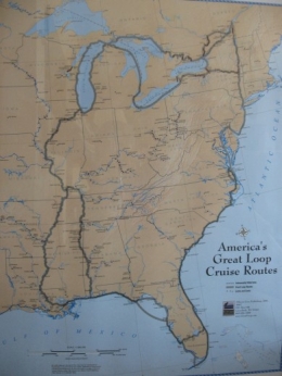
On Monday morning, the 21st, we took the cut through to the ocean. The winds were pretty light so we motor-sailed. The northerly winds were supposed to turn more to the west but that never happened (that’s because we were heading north I suppose). It was a pretty uneventful 9 hours on the water (no running aground; no sails tearing; no Sunday drivers and not a lot to see). We took the cut to the ICW at Ft. Pierce and anchored near a tiny island with one other sailboat and spent a very peaceful night. Since ABC was about the only network we could receive, Em was able to watch “Dancing with the Stars” so that was a good thing!
On Tuesday we fueled up at Ft. Pierce and headed north on the ICW. There were only three bridges today; the first one we needed to open and the other two were 65 ft. so no problem. We decided to only go the 2 hours to Vero Beach. We’d heard it was a nice place to stop and Paul somehow picked up a cold so we didn’t need another long day. There are mooring balls off the Vero Beach City Marina for $11. They were full but they had us raft off another boat, with a nice couple on s/v Mariah. They were heading below for a nap as they’d done an overnight sail all the way from Key Biscayne. There were two familiar Loopers boats here, “Another Compromise” and “Distant Shores”. We haven’t seen them since we parted ways back in Mobile, AL in November so it was fun to catch up. They had both spent time in the Bahamas where fuel was $5.30 a gallon!

This was how we spent two days in the Vero Beach mooring field. The Mariah was attached to the mooring ball and we were attached to them.

This is somebody showing off sailing around the mooring balls - it's not us!
We spent two nights at Vero Beach hoping Paul’s cold would improve. The winds really picked up Wed. afternoon. I was nearly stranded on shore doing laundry but got a ride back with our “neighbors” on Mariah. Paul was still not in great shape Thursday morning but we headed out anyway. The ICW here is the fairly wide Indian River. After 5 ½ hours on the water, we anchored in the Melbourne, FL area on the eastern shore with eight other boats. We got wet twice on the way, but most of the time it was a beautiful sunny day. It’s been in the low 80s with low humidity and really breezy out of the north. Em immediately checked the tv reception and was pleased that we get ABC pretty well. It wouldn’t be pretty if she couldn’t watch the new episode of “LOST”. Last night “American Idol” was very snowy and kept cutting out – kind of annoying! I just like to keep a connection with my “previous life”!
On Friday we left the anchorage just off the Indian River at the mouth of the Banana River about 9am. We were actually able to sail almost the whole way to Titusville – the first time that’s happened on the ICW. It’s still the Indian River here and it’s very wide with the channel well marked. We were headed north and the winds were easterly so that worked; we even sailed under the three fixed bridges. There were two that had to open for us; one the typical bascule type and the other a swing bridge. This is the Titusville swing bridge, we don't see many of these.

The Kennedy Space Center on Merritt Island was off to our right. You can see the huge Vehicle Assembly Building for miles. We’d toured the Center some years back so didn’t make the effort to take the tour again.
We anchored just off the Titusville City Marina mid-afternoon Friday. You can use their dinghy dock free for the first week; they charge $2 to use their showers. We saw another “Restless Wind” sailboat there. We saw a “Restless Spirit” last fall but never the exact same name as ours. That reminds me that we were mistakenly called “Reckless Wind” by a lock tender back in Alabama when he misunderstood us on the radio (or did he?) The good news was that it was a very calm night; the bad news was that we still couldn’t pick up a wifi signal (that’s why I got so behind with this blog!)
Here are two entries in our “sad boat contest” from the Titusville anchorage. Some of them are unbelievably neglected.


On Saturday morning we followed the ICW across the Indian River to the Haulover Canal which is a one-mile rocky cut between the Indian River and Mosquito Bay with one bridge to open. We saw lots of families kayaking and fishing. That led us into Mosquito Lagoon which was much nicer than it sounded; we were on it about 8 miles. We saw dolphins, picnics along the shore, lots of recreational boaters but they had to go slow as it was a manatee zone. This was a scene along Mosquito Lagoon with New Smyrna Beach in the background.

We had planned to stop there but decided to keep going since it was early. We saw the Ponce de Leon inlet (the cut to the ocean) and Lighthouse off to the east. This was a charter boat we encountered on the ICW near there. Most of the passengers were on the port side and it was listing a bit; it looked like a party!

We had to take the Ponce de Leon cut and it was like rush hour on the highway with all the Saturday traffic. There was dredging going on too to watch out for. This is a view looking aft. I think there are 7 boats visible.

A few of the larger cruisers will slow down to give you a slow pass but all of the little boats just roar on by. We heard on the news there was a boating fatality not too far north of us when two boats collided head on. It wasn’t hard to imagine that happening with all the traffic.
After the cut we were on the Halifax River part of the ICW. After 7 hours on the water we arrived at Daytona Beach. We anchored in about 8 feet of water just off the channel with a few other boats. We had a fairly peaceful night but at 6:18 am we were nearly rocked out of our berth by a wake. It was pretty violent; some plates even flew off a galley shelf! We never saw what caused the wake but when it’s flat calm like it was it doesn’t take much I guess. On Sunday we took a long dinghy ride to shore and looked around Daytona Beach. We checked out the Halifax Harbor Marina and found a West Marine store. Guess what – we bought a new inflatable dinghy! Paul had been looking at them for awhile now and decided to go for it.
On Monday, the 28th, we came into the marina for a pump-out, fuel and a slip for the night; first time at a marina in about 2 weeks – it’s huge with SIX shower and laundry buildings in different parts of the marina. We picked up the new dinghy and here it is. It’s a 10ft. West Marine brand RIB (rigid inflatable bottom) made of PVC which should be a smoother ride plus it won’t leak! PVC isn’t very desirable in this climate so it was less expensive but in our area it’s not a problem.

Here are some stories from the local news that you probably won’t hear in Wisconsin:
There were two shark bites over the weekend in New Smyrna Beach (the Shark Bite Capitol of the World – 20 per year). Both victims were surfers who hopped off their boards onto small sharks – ouch!
There was a dolphin accident at Sea World. Two dolphins collided during a mid-air jump and one was fatally injured – how sad.
There were 92 swimmers rescued from rip currents over the weekend on Daytona Beach. One 19-year old man is still missing.


 I guess Ginger wasn’t all that thrilled with the scenery.


 We happened to be here for the last day of the 45th Annual Shrimp Festival. The town was mobbed, a lot like Menominee, MI during the Waterfront Festival. We got some shrimp from food booths manned by local groups, walked through the juried art show and enjoyed live music. It was quite a party, complete with pirates and their ladies!
 One our way to St. Augustine, we went past Fort Matanzas, a research reserve with a lot of natural area and Rattlesnake Island. We saw a lot of dolphins along the way. The river became very winding near St. Augustine. Once at St. Augustine, we sat on the south side of The Bridge of Lions for 30 min. waiting for the opening with 5 other sailboats. The goofy bridge tender wouldn’t open because no one officially called him on the radio in time (even though he could see us all sitting there) so he made us wait until 3:30. I guess work has been going on at the bridge since 2005. Here are some of the boats going under the bridge; the lift part of it is temporary. They must have removed the decorative lions during construction as I didn’t see any.
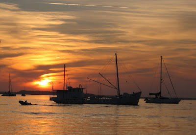
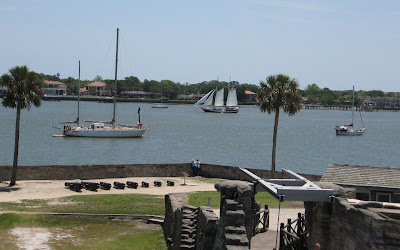
 We anchored on the north side of the bridge in Matanzas Bay and spent three nights there. The marina charges $10/day for use of their dinghy dock and facilities. It’s a fairly calm anchorage and convenient to the marina but the best part is the great view. We’re the middle boat in this view of the anchorage. This is the view of Castillo de San Marcos at dusk. The cross you see isn't actually at the fort, it's a bit further north and marks the spot where Pedro Menendez de Aviles actually landed.


 These horse-drawn carriages wait on Avenida Menendez for passengers. There were three more parked behind these two. Em’s brother Bob would have loved this. The aroma in the air was remini


 Further up the coast was Miami Beach; high rise after high rise!
 No sailing on Sunday; we stayed on the “inside”, the ICW. The view along the way was like lifestyles of the rich and famous! We haven’t seen mansions like this since Naples. Here’s a nice one with a dock for your yacht. This one wasn’t for sale but a lot of them were.
 We needed to have a total of 19 bridges opened. The first one was the Las Olmos in Fort Lauderdale and the last was the Flagler Memorial Bridge near Palm Beach. A lot of them open on request, you call them on the marine radio, and others open every quarter hour or half hour. I thought this was one of the nicer looking ones, the Ocean Avenue Bridge:
 Of course the winds really piped up by the time we anchored. We set the Fortress anchor but when we noticed it was dragging we put out the Bruce which did a fine job for us. Paul decided to sleep in the cockpit and keep one ear alerted to the depth alarm anyway. I slept okay until 3:30am when the rocking got to be a bit too much to be comfortable. The “cold” front they’d been forecasting for days arrived during the night.
 This was a strange sight to see out in the middle of the water. There are 7 of these homes left in "Stiltsville". They were built one mile offshore as gambling wasn't allowed any closer to shore. Before Hurricane Andrew in 1993, there were over 20 structures still standing and were under private lease until 1999. The Biscayne National Park Service has established a "Stiltsville Trust" to try and restore the structures and eventually open them for park use. Now that would be a water view!
 Here’s the view from where we anchored in Hurricane Harbor.


 I wasn’t able to stay in the water that long; I was feeling a bit claustrophobic with the mask and snorkel plus the waves that far out were a bit intimidating – I probably need to practice first in a swimming pool! But what I did have a chance to see of the underwater world was just beautiful. The coral and plant life and brightly colored fish are truly God’s handiwork! It was 15 – 20 ft. deep and the water was crystal clear. There are mooring balls at various places along the reef to protect it from the damage from anchors – a pretty neat system. The State of Florida and the federal government have been working together for over 25 years to protect the marine environment in the Keys. The Keys National Marine Sanctuary is North America’s only coral barrier reef and the third longest in the world. Here’s some of the group in the water and a group of yellowtails going crazy after Steve threw food overboard for them.